 Karl Friston is looking to move forward describing the ‘free energy principle’, for example using the Friston/Ramstead/Babcock paper describing “all life in terms of Markov Blankets.” https://www.wired.com/story/karl-friston-free-energy-principle-artificial-intelligence/ and https://www.sciencedirect.com/science/article/pii/S1571064517301409
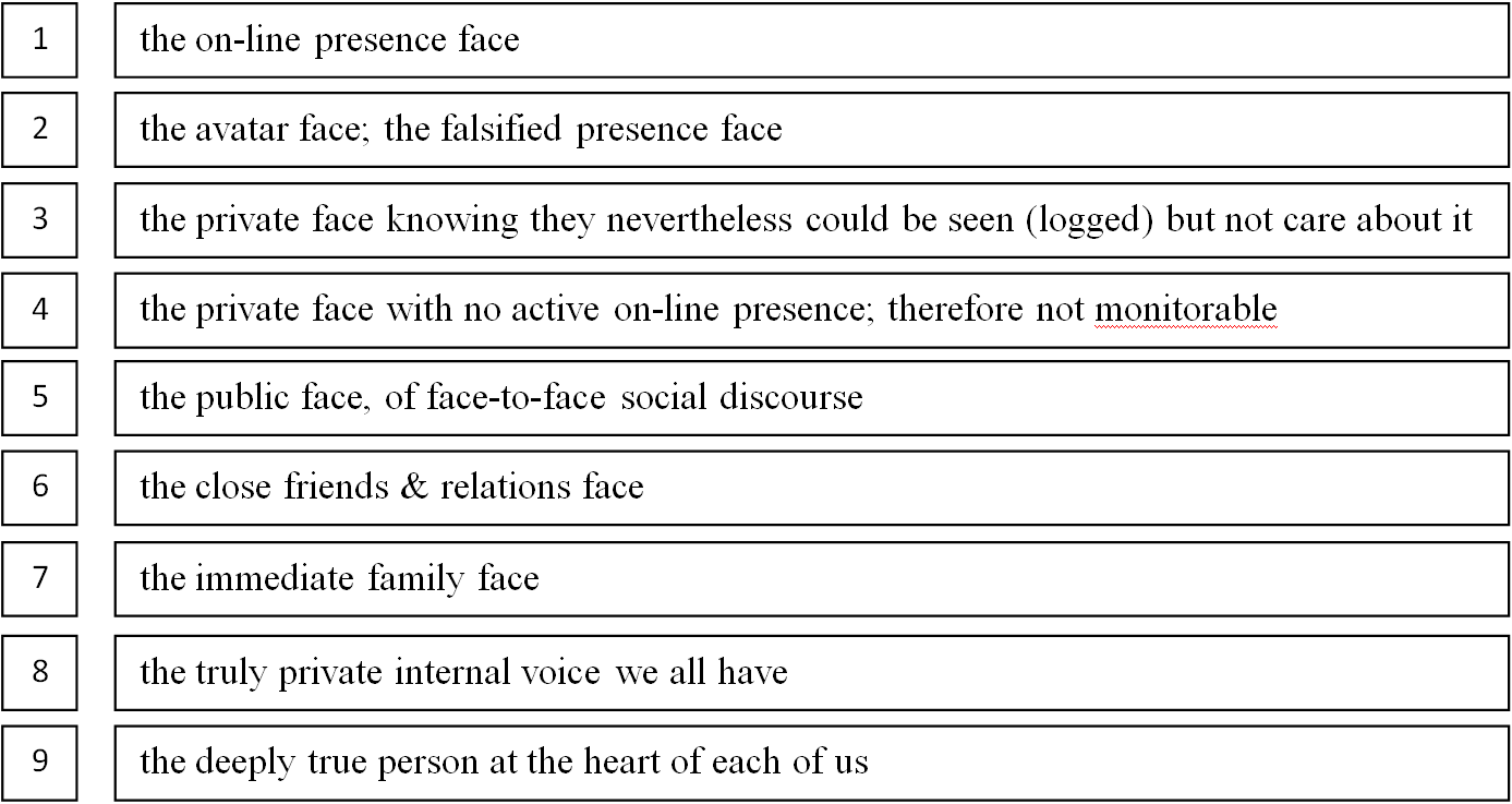
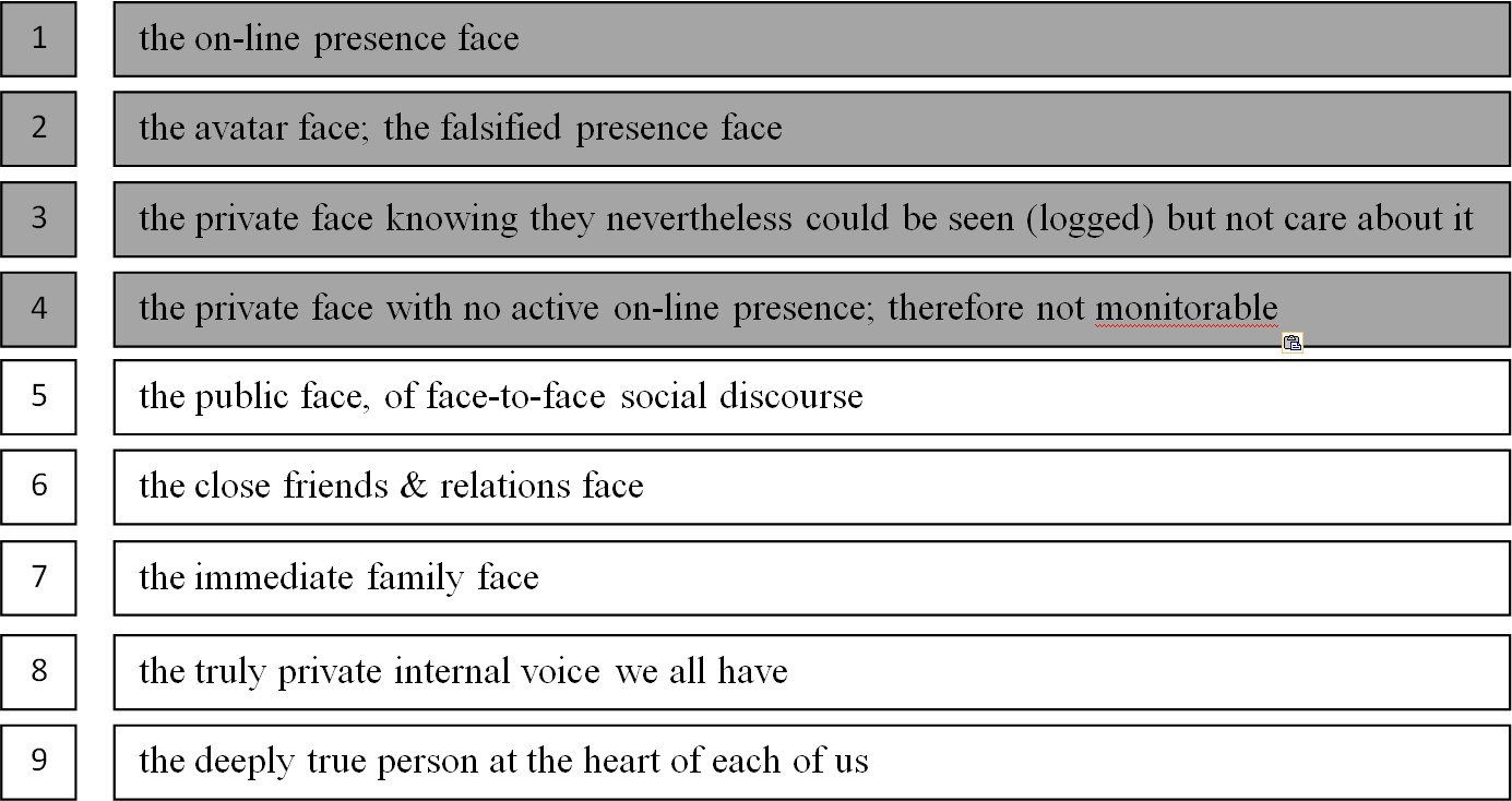
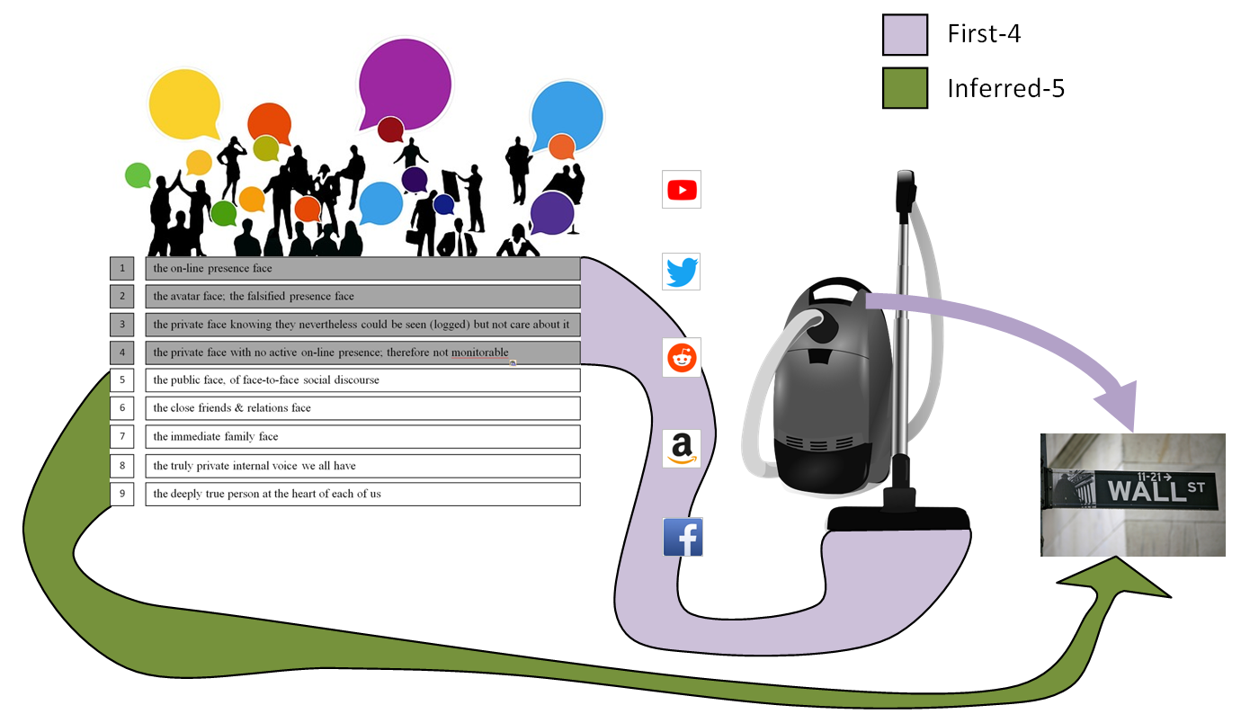
Another term for Markov Blankets might be “Liquid Membraning”. I use Liquid Membraning in problem-solving; the cognitive process appears to be akin to stitching up data-points into Markov Blankets. “Cloud-Boxing” is my other term. The suggestion here is to shift away from the rigid/fixed/ossifying nature of the term “blankets” to a flow-state framework that evokes particulates and osmoticity? Could the term instead be Markov “fluidics,” “flow-states”, “nets”, “clouds”, and/or “meshes”?
“Liquid Membraning”* is the deep enveloping that evanescently correlates datasets during the gloaming phase of a sort; stitching up cloud-points out of constellations of clues; out of a search to find the deep root cause of a challenge/problem/issue/threat [ie. to go back to the deep root first principle]. This produces a key that when turned unlocks the entire problem. Computationally you could call it super-swarming. It has been suggested that creatives approach a task ‘more intuitively’, not analytically. I disagree; these skills could be characterized as hyperfast analytical tasking. Think of super-swarming as standing in a cloud. Where the cloud is a set of data points. Among these are the discrete clues that I notice. Among these are the patterns and there a route of questions to find, to follow, down to the root clue/key that unlocks everything. Another way to look at this is to say I see all the trees in the forest, and then notice the clue paths and patterns that lead me back to the one different tree.
* definition circa 25 Nov 2018
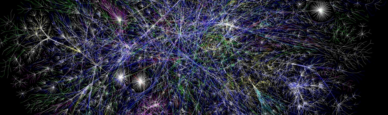
Image: “Internet map 1024” (cropped), By The Opte Project [CC BY 2.5], https://commons.wikimedia.org/wiki/File:Internet_map_1024.jpg