[sorting and citing not completed & new sources to be added]
not downloadable
- (1784) A Plan of part of the County of Lunenburg including the Townships of Chester and New Dublin, and the Lands laid out to Loyal Emigrants and Disbanded Corps. Done under the orders and directions of H.E. Governor Parr. [By Charles Morris, Surveyor-General.] Reference: CO 700/NovaScotia51. http://discovery.nationalarchives.gov.uk/details/r/C3477913
- (1784) The Draught of La Have Harbour on the Coast of Accadie, Lat. 41° 40′ N., Long. 63° 14′ W. Copied from Captn. Young’s map. MS. 4 inches to 1 mile. [1750 ?] Reference: CO 700/NovaScotia18 http://discovery.nationalarchives.gov.uk/details/r/C3477879
- (1826) Plan of Towns and Districts in Nova Scotia, M.S. 1. General plan of Nova Scotia 8 miles to 1 inch. 2. Chester, 5/8 mile to 1 inch. 3. Manchester ½ mile to 1 inch. 4. Liverpool, ½ mile to 1 inch. 5. Luenburgh, 5/8 mile to 1 inch. 6. Pictou, 5/8 mile to 1 inch. 7. Partridge Island, 170 yards to 1 inch 8. Shelbourne, ½ mile to 1 inch. 9. Aunapolis River 3/4 mile to 1 inch. 10. Yarmouth, 3/8 mile to 1 inch. Author, Publisher, &c.: Pooley Lieut, H., Halifax http://discovery.nationalarchives.gov.uk/details/r/C3477853
Histories by scholars
each has an impressive bibliography
- Clark, Andrew Hill, Acadia. the geography of early Nova Scotia to 1760, Madison, University of Wisconsin Press, 1968. Bibliography.
- Griffiths, N. E. S. From migrant to Acadian – a North American border people, 1604-1755, Montreal : McGill-Queen’s University Press, c2005. Bibliography.
- Hunter, Douglas. Half moon – Hudson and the voyage that redrew the map of the New World. New York : Bloomsbury Press, 2009. Bibliography.
- Johnston, A.J.B. : Louisbourg sources list in Land & Sea : Louisbourg-5000-Years-and-Counting.pdf https://muse.jhu.edu/chapter/253769 and http://www.ajbjohnston.com/wp-content/uploads/2012/10/A.J.B.-Johnston-Land-Sea-Louisbourg-5000-Years-and-Counting.pdf
Useful document collections and directories
Measurements
- 16th C English measurements: http://www.ianchadwick.com/hudson/hudson_06.htm
- Pre-Revolutionary French measurements: https://en.wikipedia.org/wiki/Units_of_measurement_in_France_before_the_French_Revolution
Global
- Global: Historic document archive: https://archive.org/
- Global: Historic document archive: https://babel.hathitrust.org/
- Global: Historic document archive: http://jstor.org
- Global: Historic document archive: https://www.worldcat.org/
- Global: Published research site: https://www.researchgate.net/
- Global: International Environmental Agreements (IEA) Database: https://iea.uoregon.edu/base-agreement-list
- Global: Archives of the VOC: http://www.tanap.net/content/activities/inventories/index.cfm
Canada
- Canada: Acadian history and genealogy: http://www.acadian-home.org/
- Canada: Acadian/Cajun history and genealogy: http://acadian-cajun.com/genlink.htm
- Canada: Acadia – Cartography: http://139.103.17.56/cea/axe2/carte4.cfm
- Canada: Canadian Encyclopedia: http://www.thecanadianencyclopedia.ca/
- Canada: Canadian Hydrographic Service: http://www.charts.gc.ca/documents/charts-cartes/atlantic-index.pdf
- Canada: Canadian Geographic Magazine Atlas (Royal Can. Geo. Society): http://www.canadiangeographic.com/atlas/
- Canada: National Archives: http://www.archivescanada.ca/
- Canada: Nova Scotia Archives: https://catalog.archives.gov/
France
- France: French National Archives (overseas colonies: A.N.O.M.): http://www.archivesnationales.culture.gouv.fr/anom/en/
- France: Marine Maps: http://www.historic-marine-france.com/cartes-marines/neptune-francais.htm
Great Britain
- UK: National Archives (UK Government, England, and Wales): https://www.nationalarchives.gov.uk/
- UK: British History On-line: http://www.british-history.ac.uk
- UK: British: U.Cambridge: Fleuron – A Database of Eighteenth-Century Printers’ Ornaments: https://fleuron.lib.cam.ac.uk/book_search
- UK: List of Acts of the Parliament of England: https://www.revolvy.com/
- UK: Scotland: Scottish Archives Network: http://www.scan.org.uk/index.html
- UK: Scotland: National Records of Scotland: http://discovery.nationalarchives.gov.uk/details/a?_ref=234
- UK: Wales: Archifau Cymru/Archives Wales: https://archives.wales/
- UK: Samuel Pepys’ Diary, 1660-1670: http://www.pepysdiary.com/encyclopedia/5520/
- UK: The Queen’s Royal Collection: https://www.royalcollection.org.uk/collection/topographical-prints
USA (Virginia/New Netherland/New Sweden New England)
- USA: The New Netherland Research Center, New York State Library: https://www.newnetherlandinstitute.org/research/online-publications/
- USA: Yale U: The Avalon Project: Documents in Law, History, and Diplomacy: http://avalon.law.yale.edu/17th_century/mass06.asp
- USA: New York State Library: http://www.forms2.nysed.gov/nysl/refserv.cfm
- USA: New England : http://www.newbury1635.org/websites.html
Architecture
Secondary
- Cummings, Abbott Lowell. The Framed Houses of Massachusetts Bay, 1625-1725 (Cambridge, Mass.: Harvard University Press, 1979), Chapter V, “Assembly and Rearing of the House Frame.” https://www.thoughtco.com/colonial-houses-in-new-england-178009. Vancouver Public Library, Canada., Accession No.31383089861309.
- Jenison, Paul B. “The Availability of Lime and Masonry Construction in New England: 1630-1733”, Old-time New England, Volume 67, Number 245 (Summer-Fall 1976). https://www.historicnewengland.org/explore/collections-access/capobject/?gusn=169850 : direct link: https://hne-rs.s3.amazonaws.com/filestore/1/2/8/6/0_5f09882b81a66de/
- 12860_33a310c9750a4dc.pdf
- http://com.castleton.edu/Early_Houses_Marthas_Vineyard/Part2/partiichapter08.pdf
- http://www.thecanadianencyclopedia.ca/en/article/architectural-history-the-french-colonial-regime/
- http://www.histarch.illinois.edu/plymouth/folkhouse.htm#Types
- http://www.histarch.uiuc.edu/plymouth/PDeetz.pdf
- https://www.nps.gov/tps/how-to-preserve/briefs/21-flat-plaster.htm
- https://en.wikipedia.org/wiki/Bousillage
- https://en.wikipedia.org/wiki/Plasterwork
Kiln Sources
Primary
- Graves, Bernard: “Lime Stone Kiln – Using a ‘wattle and daub’ technique” Outside Classroom, Stroud Gloucestershire, England: www.Pyrites.org – method originated in Bretagne, France. http://pyrites.org/publications_files/LIME%20STONE%20KILN.pdf
- Bernard kindly sent me to his source: the Scottish Lime Centre Trust
Secondary
- Experiments with Scandinavia field kiln https://uu.diva-portal.org/smash/get/diva2:704117/FULLTEXT01.pdf
- http://www.hmc2016.com/ Historic Mortars Conference
- The Lancashire Group of the Geologists’ Association, Established 1922. http://geolancashire.org.uk/publications-and-interpretation/the-manufacture-of-quicklime-in-lime-kilns/
- http://www.thecanadianencyclopedia.ca/en/article/architectural-history-the-french-colonial-regime/
- https://content.historicengland.org.uk/images-books/publications/iha-preindustrial-lime-kilns/preindustriallimekilns.pdf/
- http://www.lowtechmagazine.com/2013/09/lime-kilns.html
- http://www.traditionalbuilding.com/opinions/traditional-plaster-binders
- McKee, Harley J., FAIA. Introduction to Early American Masonry Stone, Brick, Mortar, and Plaster. New York: National Trust for Historic Preservation and Columbia University. 1973. https://www.worldcat.org/title/introduction-to-early-american-masonry-stone-brick-mortar-and-plaster/oclc/797050
- Parks Canada. Brenda Dunn, “Acadian Architecture in Port-Royal.” https://www.nationaltrustcanada.ca/sites/heritagecanada.org/files/magazines/2002/summer/Summer2002_Acadian.pdf
- http://novascotia.ca/natr/meb/data/pubs/81paper03/81paper03.pdf
Maps
Primary
- (1612) Champlain: Geographical Map of New France Made by Mr. de Champlain of Saintonge, Ordinary Captain for the King’s Navy https://www.wdl.org/en/item/15555/
- (1700) Romer, Wolfgang William (1640-1713), Colonel, military engineer, and cartographer: “A Mappe of Colonel Römers Voyage to ye: 5 Indian nations going from New Yorck to Albany thence west to ye 3 Macquas Castle and from ye: last Castle called Daganhoge W:S:W towards Onyades a Second nation, and thence to ye Onondages the third nation, & there I was Stoped & could not proced any forther for some important reassons & obliged to go from Onondages to ye Lake of Cananda down Cananda River till we met Onnondages River & Osweges Riv: from whence we were to returne towards Onnondages having no provision & thence to Ononyedes & from thence to ye carring place wood kill & Bever kill & so to Oneyades agin & thence to Albany as it is set forth with read pricked lines: / Anno Do: 1700.” http://explore.bl.uk/primo_library/libweb/action/display.do?tabs=moreTab&ct=display&fn=search&doc=BLL01004987682&indx=1&recIds=BLL01004987682&recIdxs=0&elementId=0&renderMode=poppedOut&displayMode=full&frbrVersion=&dscnt=2&fromLogin=true&tab=local_tab&dstmp=1493804710076&vl(freeText0)=%20K.Top.121.10.%20&vid=BLVU1&mode=Basic
- cf. New York State Library: ca. 1700 Romer map: Title: A mappe of Colonel Römers voyage to ye 5 Indian Nations : going from New York to Albany thence west … Anno D¯o. 1700; Permanent Link: http://nysl.cloudapp.net/awweb/guest.jsp?smd=1&cl=all_lib&lb_document_id=66822 – the original is noted as being at the British Museum, which advises that “The map once held by the British Museum is now held by the British Library …, which unfortunately makes no reference that I could see to Romer’s Memorial ” (personal communication, Central Archives, British Museum, 03 May 2017) :
- June 22. Boston. I send Col. Romer’s Memorial, which I have turned into English. Refers to various maps and designs enclosed….580. xii. Col. Romer to Lord Bellomont. New York, Oct. 12, 1698. Demonstrates the proper method of preparing lime on the frontiers of New York. Encloses designs and estimates; 580. xiii. Sketch of method of preparing lime. http://www.british-history.ac.uk/cal-state-papers/colonial/america-west-indies/vol18/pp354-380.
- Oct. 12. New York. 886. Colonel Romer’s report to Lord Bellomont on New York’s. I send the plans of the several works which I have designed [missing]. If any works be begun during my absence, the lime burned out of stone at Albany is not sufficiently good for the work, as it does not dissolve itself—I suggest the following method for dissolving it. Here follow elaborate details as to the method,…886. I. A drawing of the engine for making lime. http://www.british-history.ac.uk/cal-state-papers/colonial/america-west-indies/vol16/pp472-478.
- (1715) Bowles: A new and exact map of the dominions of the King of Great Britain on ye continent of North America : containing Newfoundland, New Scotland, New England, New York, New Jersey, Pensilvania, Maryland, Virginia and Carolina, 1715 [i.e. 1731] Published by Bowles, John (1701-1779) Moll, Herman (d. 1732 ) & Bowles, Thomas (1694-?). Lionel Pincus and Princess Firyal Map Division, New York Public Library Digital Collections: https://digitalcollections.nypl.org/items/510d47da-f11a-a3d9-e040-e00a18064a99
- (1715-1758) Seutter: Partiale Orientale de la Novelle France or du Canada avec L’Isle de Terre-Neuve et de Novelle Ecosse Acadie et Nouv. Angleterre avec Fleuve de st Laurence Reprefente par Math. Seutter Georg. De S.M. Imper d’Augsbourg. [1715 to before 1758]. Acadia University, William Inglis Morse collection, Accession No.1931.004-WIM/61. [updated age of this map for Acadia’s archivist].
- (1733) Popple: (Composite Map of) A Map of the British Empire in America with the French and Spanish Settlements adjacent thereto. by Henry Popple. C. Lempriere inv. & del. B Baron Sculp. To the Queen’s Most Excellent Majesty This Map is most humbly Inscribed by Your Majesty’s most Dutiful, most Obedient, and most Humble Servant Henry Popple. London Engrav’d by Willm. Henry Toms & R.W. Seale, 1733. List No: 2874.002 Series No: 3. Engraver or Printer: Baron, B.; Engraver or Printer: Lempriere, C. Acadia University: David Rumsey Historical Map Collection, http://www.davidrumsey.com/maps1901.html and http://www.davidrumsey.com/luna/servlet/detail/RUMSEY~8~1~887~70081:-Composite-Map-of–A-Map-of-the-Bri,
- (1768) Montresor: Map of Nova Scotia or Acadia with the Islands of Cape Breton and St. John’s From Actual surveys, by Captn Montresor, Engir, 1768, William Inglis Morse collection, Acadia University, Accession No. 1931.004-WIM/62h
- (1778) Des Barres: Nautical remarks and observations on the coasts and harbours of Nova Scotia: surveyed to orders form the Right Honble. the Lords Commissioners of the Admiralty, for the use of the Royal Navy of Great-Britain. by Des Barres, Joseph F. W. (Joseph Frederick Wallet), 1722-1824. Published 1778. Filmed from a copy of the original publication held by the Harold Campbell Vaughan Memorial Library, Acadia University
- cf. Arbitration by the King of the Netherlands under Terms of the Convention of September 29, 1827, between the United States and Great Britain. 9/29/1827-1/12/1831. U.S. National Archives: wocf. Arbitration by the King of the Netherlands under Terms of the Convention of September 29, 1827, between the United States and Great Britain. 9/29/1827-1/12/1831. U.S. National Archives: works and observations on the coasts and harbours of Nova Scotia: surveyed to orders form the Right Honble. the Lords Commissioners of the Admiralty, for the use of the Royal Navy of Great-Britain. by Des Barres, Joseph F. W. (Joseph Frederick Wallet), 1722-1824. Published 1778. Filmed from a copy of the original publication held by the Harold Campbell Vaughan Memorial Library, Acadia University cf. Arbitration by the King of the Netherlands under Terms of the Convention of September 29, 1827, between the United States and Great Britain. 9/29/1827-1/12/1831. U.S. National Archives: https://catalog.archives.gov/id/10472247 cf. https://archive.org/stream/cihm_26089#page/n33/mode/2up/search/king%27s+bay
- -and – 1780: J.F.W. Des Barres, The South West Coast of the Peninsula of Nova Scotia, by Order of the Right Honourable the Lords Commissioners of the Admiralty (part two), 1780. J.F.W. Des Barres collection – Accession No. 1982.010-DES/4, http://openarchive.acadiau.ca/cdm/singleitem/collection/DesBarres/id/2/rec/8
- Note about the cartographer Col. J.F.W.Des Barres: http://www.heritagecharts.com/mapchart.php/7/7/j_f_w__ Examine the clip of his 1799 survey, held at the US Library of Congress. The islands are all easy to distinguish. des Barres’ work is absolutely brilliant, the best of its day, evidencing a meticulous mind engaged in exacting practice of his craft.
Secondary – Global
- Global: 4000 viewable historic maps: http://freegeographytools.com/2009/historic-french-maps-17th-19th-century –
- Global: The Atlas of Mutual Heritage http://www.atlasofmutualheritage.nl/en/ This is a database with information, maps, drawings, prints and paintings of locations related to the Dutch East India Company (Verenigde Oost-Indische Compagnie, VOC) and the West-Indische Compagnie (WIC).
- Global: Historic Mapworks: http://www.historicmapworks.com/Search/search.php
Secondary – Region-specific
- Canada. Canadian Hydrographic Service – Modern Charts (Atlantic Region): http://www.charts.gc.ca/documents/charts-cartes/atlantic-index.pdf
- http://www.historicmapworks.com/Search/search.php
- Cartography of Acadia: http://139.103.17.56/cea/axe2/carte4.cfm
- http://www.acadian-home.org/maps.html
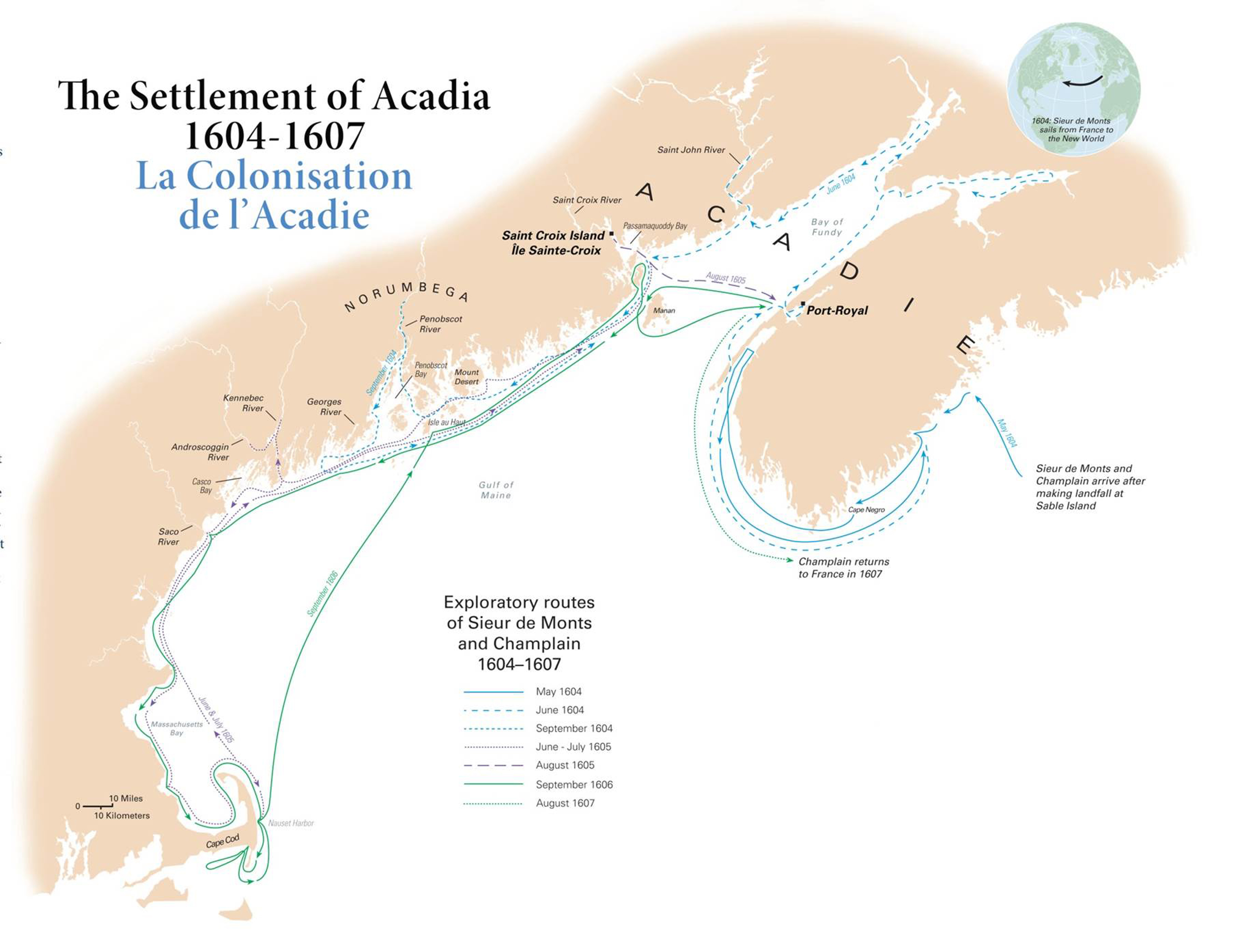
- https://umaine.edu/canam/wp-content/uploads/sites/149/2009/10/settlement-of-acadia-map.jpg
- https://commons.wikimedia.org/w/index.php?curid=1351882usdoi-17c-acadia map
- http://acim.umfk.maine.edu/map13_photo.html
- 1750 map: By Chnou – Own work, CC BY-SA 4.0. http://acadian-cajun.com/acadia1.htm.
- http://www.cmhg.gc.ca/cmh/page-174-eng.asp
- http://www.canadiangeographic.com/atlas/themes.aspx?id=fishery&sub=fishery_centuries_16th&lang=En
- Explanatory Maps of Saint Croix & Acadia: www.umaine.edu/canam
- Discovery/trade connections (1600s): http://www.acadian-home.org/map-of-acadia.html
- http://www.acadian-home.org/map-Acadia-before-1755.html
- The Netherlands: Dutch Cartography in the 16th and 17th Century: http://european-heritage.org/netherlands/alkmaar/dutch-cartography-17th-century
- France: Marine Maps: http://www.historic-marine-france.com/cartes-marines/neptune-francais.htm
Historical sources
- (1609) Juet’s journal; the voyage of the Half Moon from 4 April to 7 November 1609. https://www.worldcat.org/title/juets-journal-the-voyage-of-the-half-moon-from-4-april-to-7-november-1609/oclc/564876 https://babel.hathitrust.org/cgi/pt?id=mdp.39015010481805;view=1up;seq=7 and https://www.nytimes.com/interactive/projects/documents/robert-juet-s-journal-of-hudson-s-1609-voyage
- (1632) Voyages of Samuel de Champlain, 1604-1618; by Champlain, Samuel de, 1567-1635; Grant, W. L. (William Lawson), 1872-1935, ed. New York: C. Scribner’s Sons, 1907 “This volume presents the texts of the Voyages of 1613 and the Voyages et descouvertures of 1619, as given in the excellent translation by Dr. Charles Pomeroy Otis, in the second and third volumes of the late Dr. Edmund F. Slafter’s Voyages of Samuel de Champlain, published in three volumes by the Prince Society.”– https://archive.org/details/voyagesofsamueld00cham
- (1638) “A sketch of the life of Thomas Lechford. By J. Hammond Trumbull”: p. [vii]-xxviii, Note-book kept by Thomas Lechford, esq., lawyer, in Boston, Massachusetts bay, from June 27, 1638, to July 29, 1641 by Lechford, Thomas, ca. 1590-1644? cn; Hale, Edward Everett, 1863-1932, ed; Trumbull, James Hammond, 1821-1897. Edited by Edward Everett Hale, jr., from the original manuscript, with the use of notes and material prepared by J. H. Trumbull and others, 1885. https://ia801408.us.archive.org/26/items/notebookkeptbyth00lech/notebookkeptbyth 00lech.pdf
- (1671-72) Denys, Nicholas, The description and natural history of the coasts of North America (Acadia). English translation, Champlain Society, introduction p.15-16: 1677 https://archive.org/stream/descriptionandn00paltgoog#page/n32/mode /2up/search/lime –(1737?) Higgins, Bry. (Bryan), 1737?-1820, Experiments and observations made with the view of improving the art of composing and applying calcareous cements and of preparing quick-lime: theory of these arts; and specification of the author’s cheap and durable cement, for building, in crustation or stuccoing, and artificial stone, 1780. Book digitized by Google from the library of the University of Michigan. https://archive.org/details/experimentsando01higggoog
- (1710-1867) Nova Scotia and Privateering: Selections from the Colonial Office (CO 217) Great Britain. Colonial Office. Original Correspondence: Nova Scotia and Cape Breton 1710-1867 https://loyalist.lib.unb.ca/sites/default/files/CO%20217.%20Nova%20Scotia%20and%20Privateering%20Selections.pdf
- (1744) A journey through Nova-Scotia, containing, a particular account of the country and its inhabitants: With Observations on their Management in Husbandry; the Breed of Horses and other Cattle, and every Thing material relating to Farming. To which is added, An Account of several Estates for Sale in different. Townships of Nova-Scotia, with their Number of Acres, and the Price at which each is set. By John Robinson, farmer at Bewholm, in Holderness, and Thomas Rispin, farmer at Fangfoss, both in the County of York, Who sailed for Nova-Scotia, the 8th of April, 1774, from Scarbrough, on Board the Ship Prince-George. Robinson, John, farmer. Rispin, Thomas. York: printed for the authors, by C. Etherington, 1774. https://archive.org/details/cihm_20477(1896) “Robert Sedgwick – A Sketch.” A pamphlet by Henry Dwight Sedgwick reprinted from the publications of the Colonial Society of Massachusetts Vol III, Cambridge, John Wilson and Son, University Press, 1896, sedgwick.org – Sedgwick Genealogy Worldwide. Major General Robert Sedgwick (c. 1611 – 1656) was an English colonist to Massachussets and Jamaica. First commander of the Castle in Boston Harbour in 1641 after ordering it built, and was major-general of the Massachusetts forces in 1652. see: http://www.sedgwick.org/na/library/books/sed1896/sed1896.html.
- (1874) Sampson, Henry, Discussion of the South Sea Bubble, A History of Advertising from the Earliest Times. Illustrated by Anecdotes, Curious Specimens, and Biographical Notes. London: Chatto and Windus, Piccadilly. 1874. https://www.gutenberg.org/files/54149/54149-0.txt
- (1896) Prowse, D. W. (Daniel Woodley), A history of Newfoundland, from the English, colonial, and foreign records, London: Eyre and Spottiswoode, 1896.
Secondary
- Cavendish, Richard, “Execution of Captain Kidd”, Richard Cavendish recalls the death of the pirate William Kidd, executed on May 23rd, 1701. History Today, Volume 51 Issue 5 May 2001. https://www.historytoday.com/richard-cavendish/execution-captain-kidd
- “Les aboiteaux : piliers de l’expansion acadienne”, L’Acadie par les cartes – 400 Ans de presence Francaise au Canada, 1604-2004. Projet en partenariat avec : Centre de recherche en civilisation canadienne-française (CRCCF). Société historique de saint-boniface (shsb) & Les collectivités francophones et les métis au coeur de l’amérique. Le Maitre Guillaume Université d’Ottawa. © Université de Moncton. Centre d’études acadiennes (CEA), 2004. http://139.103.17.56/cea/documts/notices/htm.cfm?ret=ed2&ident=T0032
- Swayze, Ken, Archaeological Discovery in Organic Terrain in Canada – The Potential for Archaeological Discovery In Organic Terrain In Canada. Canadian Museum of History, Gatineau: QC.http://www.historymuseum.ca/learn/research/resources-for-scholars/essays/archaeology/archaeological-discovery-in-organic-terrain-in-canada/
- William Kidd: https://en.wikipedia.org/wiki/William_Kidd
- European fortifications built in north america: 1600-1699. http://peter.mackenzie.org/history/hist425B.htm
- Biography of Perrot, Francois-Marie, Seigneur de Sainte-Geneviève, governor of Montreal 1669–84 and of Acadia 1684–87. http://www.biographi.ca/en/bio.php?id_nbr=515
- http://www.terriau.org/jehan.htm
- Bernard, Shane K., Les Cadiens et leurs ancêtres acadiens: l’histoire racontée aux jeunes. Traduit de l’anglais par Faustine Hillard, 2013: U.Mississippi Press. https://www.jstor.org/stable/j.ctt24hvxk
- https://www.acadian.org/history/tracing-origin-acadians/
- https://journals.lib.unb.ca/index.php/ag/article/view/atlgeol.2014.002/25723
- https://commons.wikimedia.org/w/index.php?curid=45842705
- https://en.wikipedia.org/wiki/Acadia#Economy
- https://en.wikipedia.org/wiki/Germain_Doucet
- http://www.genealogy.com/ftm/b/e/l/Steven-F-Belanger/GENE1-0063.html
- http://www.hmdb.org/marker.asp?marker=78260
- http://freepages.genealogy.rootsweb.ancestry.com/~ked1/1755vict.html
- https://en.wikipedia.org/wiki/Siege_of_Port_Toulouse
- https://www.cambridge.org/core/journals/itinerario/article/div-classtitlerecords-in-a-rivalandaposs-repository-archives-of-the-dutch-east-india-company-and-related-materials-in-the-india-office-records-british-library-london-and-the-national-archives-of-malaysia-kuala-lumpurdiv/F457C4A2D127E30909F98EEBD731E2E0
- http://www.ianchadwick.com/hudson/hudson_03.htm
- “Robert Sedgwick – A Sketch.” http://www.sedgwick.org/na/library/books/sed1896/sed1896.html, and sedgwick-robert1613.html
- http://militiadescendants.org/files/documents/units0603.pdf
- http://www.ecga.org/explore_our_properties/view_property/1415-jennie_lagoulis_reservation_at_four_rock_devils_den
- http://acadian-cajun.com/genlink.htm
- http://www.ajbjohnston.com/wp-content/uploads/2012/10/A.J.B.-Johnston-Land-Sea-Louisbourg-5000-Years-and-Counting.pdf
- Newbury – A Brief History (Massachusetts): http://magenweb.org/Essex/Newbury/history.htm
- The International Fishery of the 16th Century: http://www.heritage.nf.ca/articles/exploration/16th-century-fishery.php
Recent geography reports
Primary
- (2005) Gagnon, Patrick & Herbert T. Ripley, William Jones, Robert E. Scheibling, Bruce G. Hatcher. INVA – Session Nine: Coastal Habitat — Eelgrass and Salt Marsh. Hyperspectral imaging for mapping subtidal invasive algal species.cf. J. A. Percy, A. J. Evans, P. G. Wells and S. J. Rolston (Eds.). 2005. The Changing Bay of Fundy: Beyond 400 Years. Proceedings of the 6th Bay of Fundy Workshop, Cornwallis, Nova Scotia, September 29th – October 2nd, 2004. Environment Canada – Atlantic Region, Occasional Report No. 23. Dartmouth, NS and Sackville, NB. Hyperspectral Data International, Halifax, NS. https://www.researchgate.net/publication/254070190_HYPERSPECTRAL_IMAGING_FOR_MAP
- (2011) Finck, W., Carbon 14 Dating of Intertidal Tree Stumps, Roots, Peat and Shells on the Outer Islands of Mahone Bay, Nova Scotia, 2011: in Mineral Resources Branch, Report of Activities 2010; Nova Scotia Department of Natural Resources, Report ME 2011-1, p. 15-19. citing:
- (2005) Gehrels, W. R., Kirby, J. R., Prokoph, A., Newnham, R. M., Achterberg, E. P., Evans, H., Black, S. and Scott, D. B. 2005: Onset of rapid sea-level rise in the western Atlantic Ocean; Quaternary Science Reviews, v. 24, p. 2083 – 2100. https://www.novascotia.ca/natr/meb/data/pubs/11re01/11re01_05FinckMahoneBay.pdf
- (2009) Forbes, D. L., Manson, G. K., Charles, J., Thompson, R. B. and Taylor, R. B. 2009: Halifax Harbour extreme water levels in the context of climate change: scenarios for a 100- year planning horizon; Geological Survey of Canada, Open File 6346.
- (2012) Johnston, A.J.B., Land & Sea & Louisbourg: 5000 Years and Counting, http://www.ajbjohnston.com/wp-content/uploads/2012/10/A.J.B.-Johnston-Land-Sea-Louisbourg-5000-Years-and-Counting.pdf
- (2013) Caines, Joshua Ryan, An investigation of factors influencing the erosion of drumlin islands in Mahone Bay, Nova Scotia. Thesis, Bachelor of Science with Honours in Geology, Acadia University, April, 2013. http://coastalaction.org/Wordpress/wp-content/uploads/2015/06/j_caines_thesis_final.pdf
Secondary
- ‘Solution caves are formed in carbonate and sulfate rocks such as limestone, dolomite, marble, and gypsum by the action of slowly moving ground water that dissolves the rock to form tunnels, irregular passages, and even large caverns along joints and bedding planes.” https://www.nature.nps.gov/geology/usgsnps/cave/cave.html
- 160 years of weather records continuously taken at Halifax Citadel. 2017-Halifax-Citadel-temp-and-precipt-climate-normals. http://www.agr.gc.ca/eng/science-and-innovation/agricultural-practices/agriculture-and-climate/future-outlook/climate-change-scenarios/length-of-growing-season-in-the-atlantic-region/?id=1362693917081“
- Climate of Nova Scotia: Temperature and Precipitation. https://en.wikipedia.org/wiki/Climate_of_Nova_Scotia
- Local Effects – Southwest Nova Scotia – Yarmouth to Halifax and Vicinity”, LAWM-Atlantic, Chapter 4, Seasonal Weather and Local Effects: Local Area Weather
- Manuals, Nav Canada, p.73-75. http://www.navcanada.ca/EN/media/Publications/Local%20Area%20Weather%20Manuals/LAWM-Atlantic-4-EN.pdf
- Probability of a tropical cyclone of tropical storm or hurricane strength at a specific date, expressed as systems per 100 years. https://en.wikipedia.org/wiki/File:North_Atlantic_Tropical_Cyclone_Climatology_by_Day_of_Year_Graph.