The constellation of data leads me to speculate that Whitestaunton’s (known) Roman Bathhouse is attached, not to the villa of a farming estate, but to a military commander’s villa as an appurtenance of the office. Is the site at the centre of a network of military roads crossing the region? And a fort(let), such as a location on the ridge near Horse Pool Camp?
DEFRA [HM Department for Environment, Food & Rural Affairs] will be conducting a lidar survey of South Somerset in the near future (possibly Spring 2019). I’m waiting to inspect imagery.
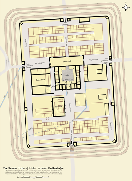
https://www.ancient.eu/image/5989/plan-of-a–typical-roman-fort/