During the Black Death, did the Priory create the world’s first Industrial Revolution?
SUMMARY:
St Osyth, Tendring District, County of Essex, ~12 miles SE of Colcheter [map link].
 An English village and civil parish named after Osgyth, a 7th-century saint and princess. The local pronunciation of the name is “Toosey”. The parish “is claimed to be the driest recorded place in the United Kingdom.” It is the site of a large Augustinian Abbey surrendered to the Crown during the 16th C Dissolution of the Monasteries. [wiki]
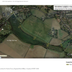
Channel 4’s Time Team explored a wooden structure at a bend in the estuary west of Mill Street, and then the church and village centre. (Series 12, Ep.9, “Lost Centuries of St Osyth” February 2005): “The programme sought to uncover the early origins of the village, which was presumed to have grown up about the same time as the Priory, in the 12th century. Many of the investigations around the current village centre found little evidence of settlement earlier than the 14th century; it appeared that the early village centre lay some way off, between the Priory and the river.”
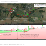
This piqued my interest about the estuary, earthworks farther upstream, and the crossings of the creek at high tide in those ancient times. That led me to looking at Dam (and Mill Dam) sites. And that led to a review of British History On-line notes about the abbey. Then this came to light: In 1433, the abbey was audited by Dr. Z.Mulakyn representing Bishop Fitzhugh. The audit reported that there were “mill dams” (plural).
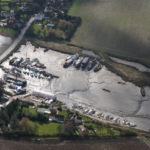 But in the modern era (18th C forwards) there seems to be only one mill dam, a Tide Mill [constructed 1720, last used 1949, destroyed in a gale in 1962]. The Francis Frith collection has a photo of it here [link]. Terry Joyce’s image at left is looking across the estuary to the SE. The road crosses the mill dam. The mill was located on this side of the creek [St Osyth Creek and Boatyard cc-by-sa/2.0 – © terry joyce – geograph.org.uk/p/2145184]
The First Industrial Revolution?
And then I got to looking deeper. Wondering about available labour. And then took a look at the death rates of the late Mediaeval. My word. The numbers.
In the Industrial and now Digital Era, we generally have come to think that “more machinery” = less work = less employment = a threat to workers. In the Age of Plague: higher deaths = lesser availability of labourers = could produce demand for additional machinery to leverage the limited hands available.
A mill is “machinery.”
Did St. Osyth’s Priory build more dams to manage labour shortages? Make a new effort to manage declining food supplies? Put their focus to helping the living? Initiating the world’s first early modern Industrial Revolution, 350 years before Abraham Darby?
The 15th century equivalent of Darby’s Coalbrookdale Smelter near Ironbridge, Shropshire?
Challenge: Search for earlier village centres over several eras
Idea: Evaluate where dams and/or mills might have been located. Use to evaluate dwelling concentrations over time.
Where were the dams?
How far would villagers walk to a mill dam?
Does this produce loci of activity to identify early village sites?
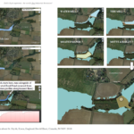
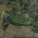
Imagine if money was no object. And we could lay a dike (yellow line, image 6) across the harbour below the Tide Mill wharf during the driest months of summer. And dig out the ponds from the dike, to the 1720 Tide Mill site, and thence to the head of the estuary? Or put coffer dams at the likeliest artefact deposition hotspots? Imagine what we might find in all those centuries of muck? Imagine if there were enough artifacts to trace the technology of mediaeval mill-dams? And the bracketing millennia; from Neolithic to Now? This would be neat!
![]() This is all I can do on this. My hobby focus is an anomaly at (a) Whitstaunton, Somerset and (b) Champlain’s 1613 traverse up the Ottawa River. I’ve sent a note to the Parish Museum. Here are the notes and search screenshots:
This is all I can do on this. My hobby focus is an anomaly at (a) Whitstaunton, Somerset and (b) Champlain’s 1613 traverse up the Ottawa River. I’ve sent a note to the Parish Museum. Here are the notes and search screenshots:
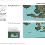
Notes [pdf link]. Screenshots: Select Thumbnail to see Full Size.

