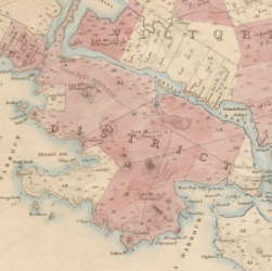
Whilst researching land issues in the provincial Capital Regional District (Victoria, BC) came across an 1854 survey of properties. This …


Whilst researching land issues in the provincial Capital Regional District (Victoria, BC) came across an 1854 survey of properties. This …
Charts & Surveys circa 1592-1900 ~ image clips added to documents list: https://davehuer.com/cartoproblematica/atlantean/maritime-puzzles/mahone-bay-treasures/research-notes/mahone-bay-charts-surveys/
https://archive.org/details/atlasofunitedsta00roge (1857) The cartographer and printer producing a fine, delicately tinted map. This close-up showing the border of BC and …