Cartoproblematica hobby work is on hold. My focus is to lead the venture OrbMB Technologies Corp.

discovering unknown treasure in the karst & cave mapping of the world & the reproducible evidence thereto

Cartoproblematica hobby work is on hold. My focus is to lead the venture OrbMB Technologies Corp.

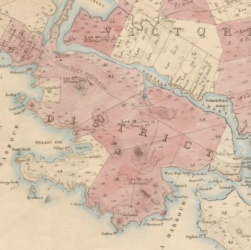
Whilst researching land issues in the provincial Capital Regional District (Victoria, BC) came across an 1854 survey of properties. This …

In the midst of researching the Nova Scotia coast during 2017, I came across a map of the Grand Banks …
One of the neat things about a hobby like this is meeting people across Canada and around the world who …
Charts & Surveys circa 1592-1900 ~ image clips added to documents list: https://davehuer.com/cartoproblematica/atlantean/maritime-puzzles/mahone-bay-treasures/research-notes/mahone-bay-charts-surveys/
https://archive.org/details/atlasofunitedsta00roge (1857) The cartographer and printer producing a fine, delicately tinted map. This close-up showing the border of BC and …
It is time to be starkly explicit. My research suggests that the original, pre-contact, trail is the Lake and canoes …
Col. Engineer Römer’s ca. 1698 Memorial & Mappe I’ve been searching out liming technologies (kilns of various designs) and from …
An interesting anomaly during the Mahone Bay smuggling investigations, noticed earlier this year. Boston, MA officially imported limestone from England …
Pre-contact/early colonial trail – first list of references Primary mss & maps + secondary sources Notes on Captain G.H.Richards, RN …
Sometimes lucky! I’ve been researching Royal Navy sources for a document on lime manufacture, circa 1700. During that search, found …
This is a screenshot of a Parliamentary Precinct security officer’s shoulder patch. Compare it to the image at Parliament’s home …