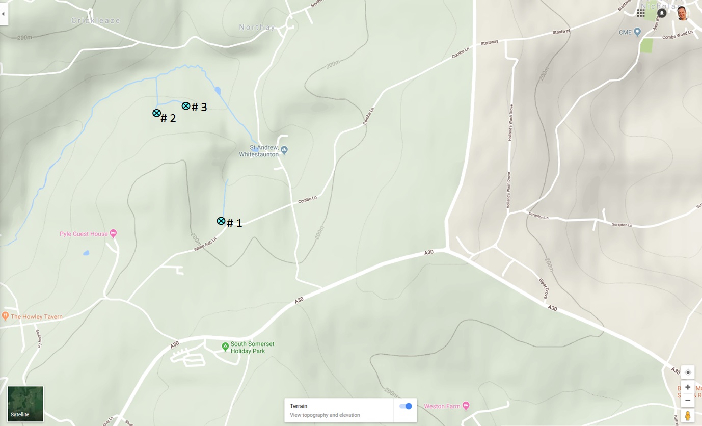
whit-01 [topo & weather]
whit-village-speculations [proto lumps and bumps]
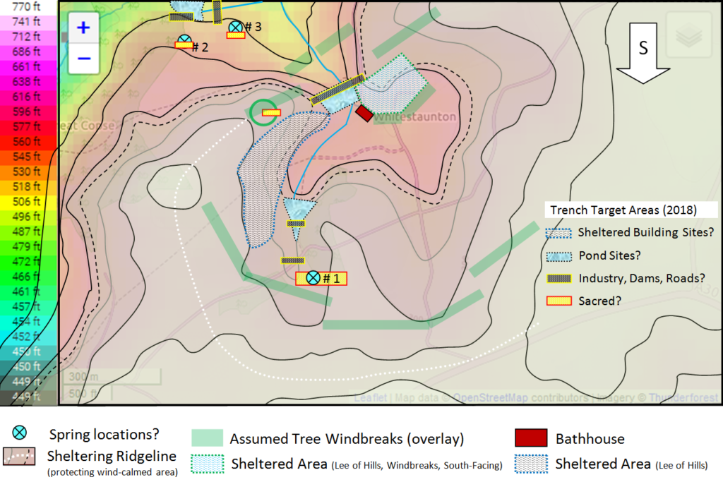
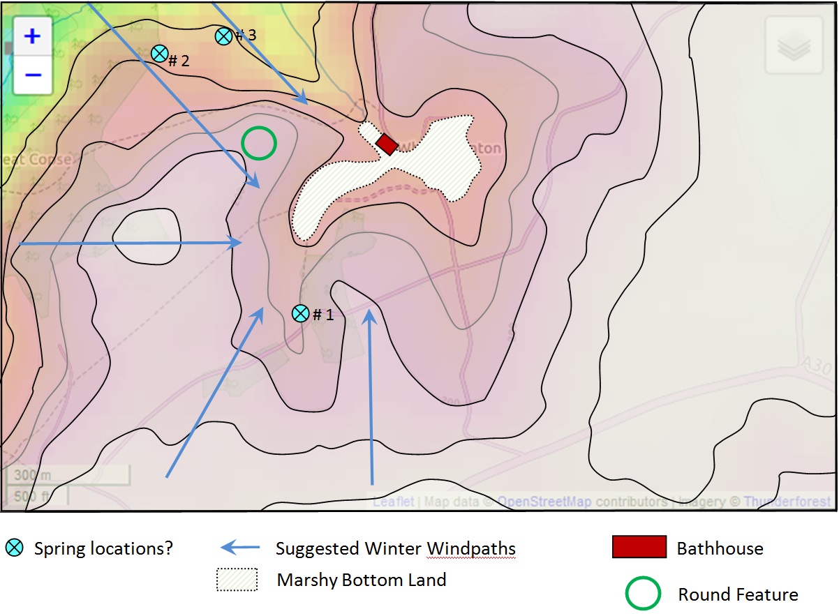
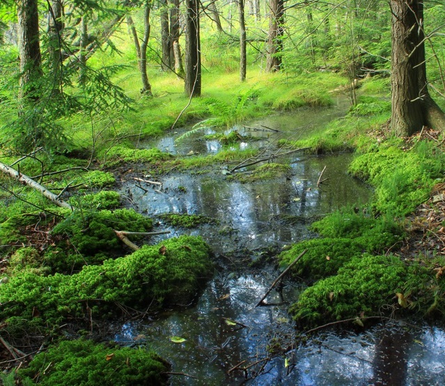
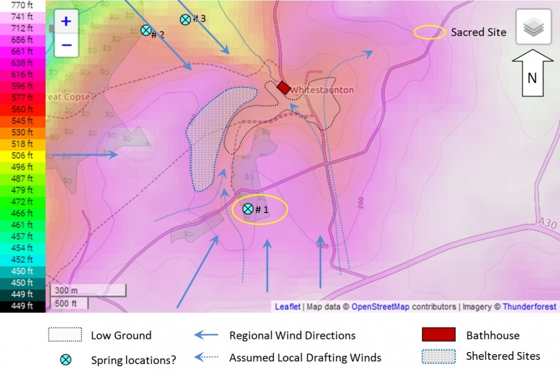
Topography shapes our use of a landscape. The Celts worshiped at sacred forest groves and at water places. The presence of marshy land in a pocket valley fed by a spring gives rise to the speculation that this might produce conditions for veneration by the local Celtic confederacy, the Durotriges: a spring, stream, marsh, pond, enclosed in a small valley cupped by smoothly sloping ridges. The round copse on the slope to the west is also intriguing [see “Round Copse” page].
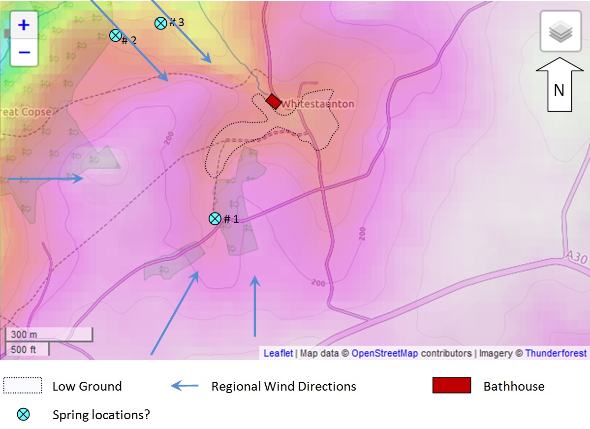
Newcomers encounter a sheltered “pocket valley” with rich marshy bottom land, fed by a spring running north to a “notch” or “nock” exiting at the north end of the pocket.

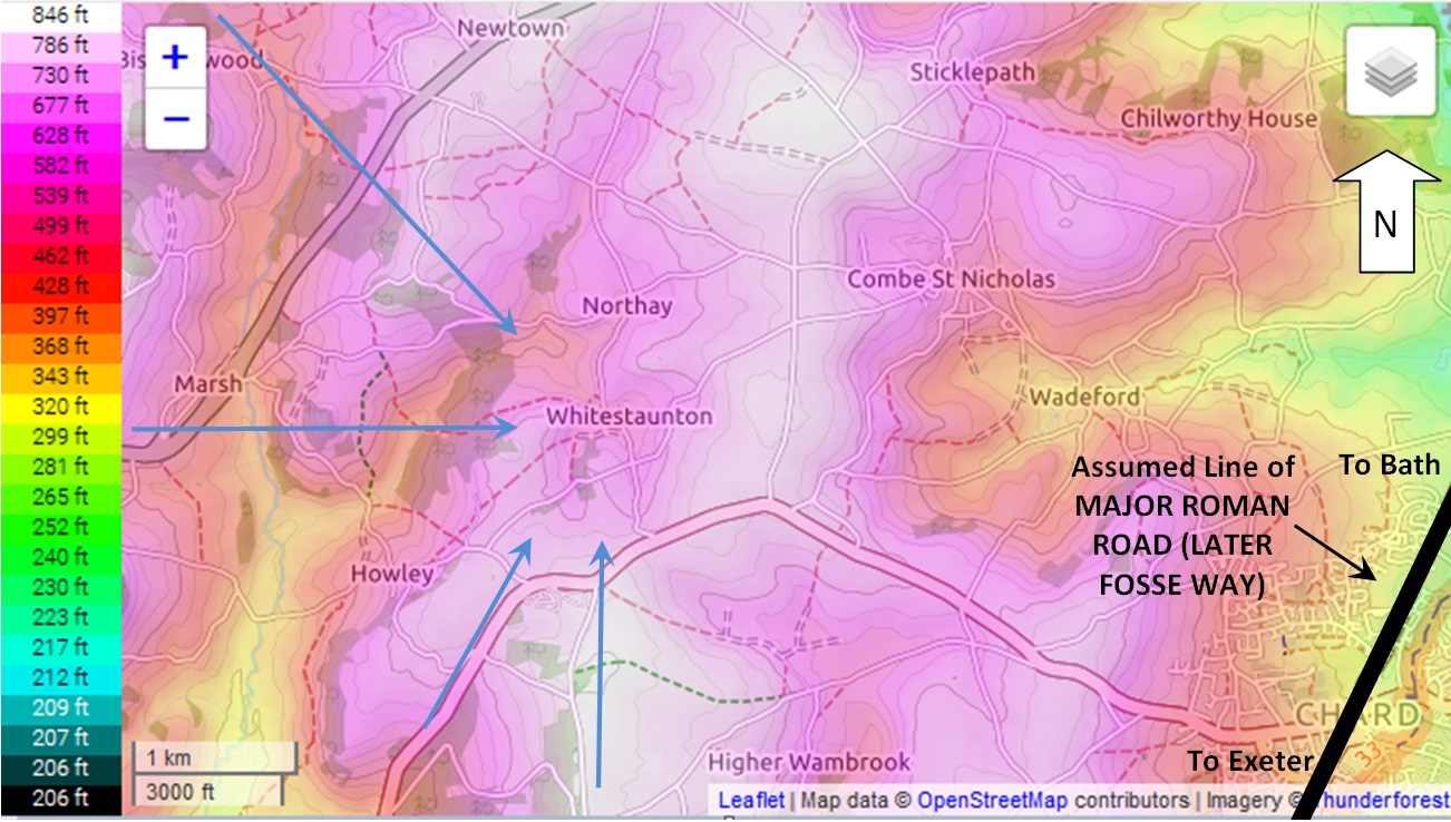
Regional winds come from the West, South-West and South.
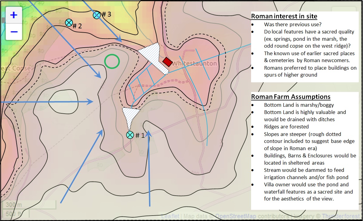
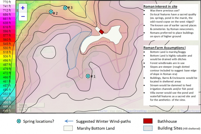
A) The settlers, whether Roman or Romanized Britons, use Imperial water engineering to capture spring waters for irrigation and fish-rearing, whilst venerating the upland spring as a sacred place.
They drain the marsh (where the manor parklands are located now) and capture the waters into a second pond at the “notch”, the narrow exit at the north end of the valley. They reserve these drained bottom lands as high-value fields.
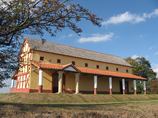
B) The residential building is located on slopes sheltered from the area’s prevailing winds; and uses planted windbreaks to maximize protection. The villa bathhouse looks out across the valley, in a south-facing nook.
C) Nearby springs, located to the northwest (just outside the pocket on the north slope of Great Hill) are captured to irrigate the bottom lands below the narrowing “notch” of the pocket valley.

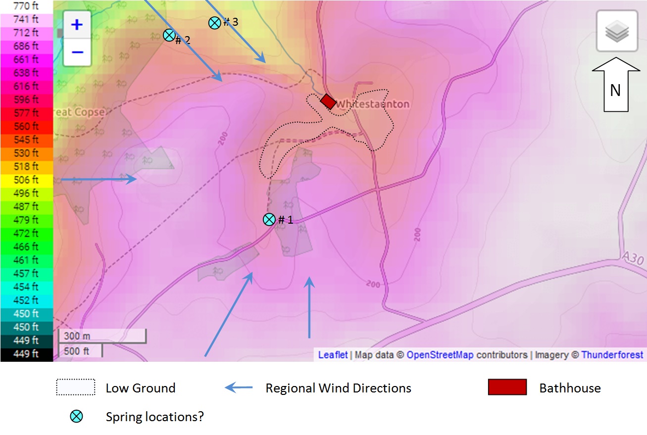
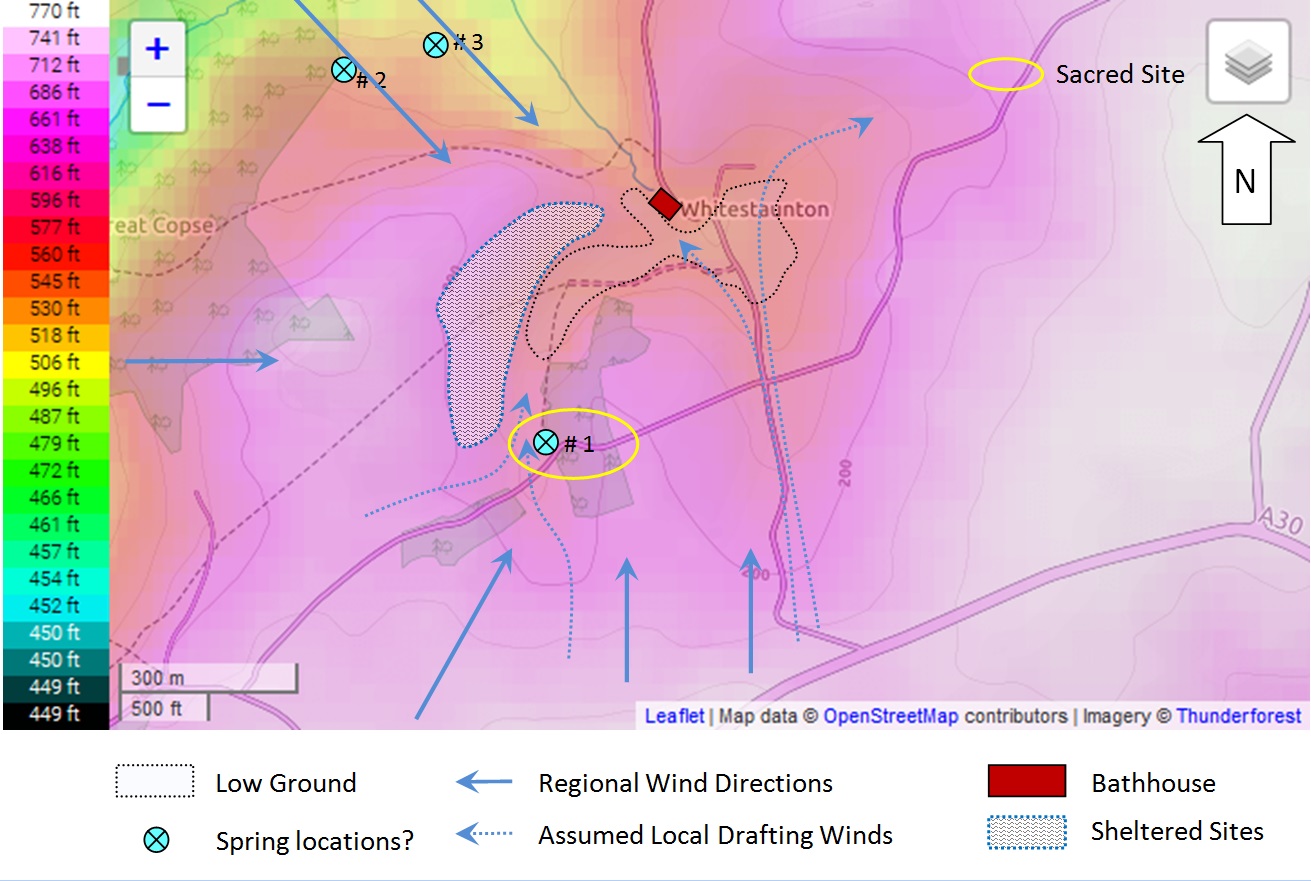
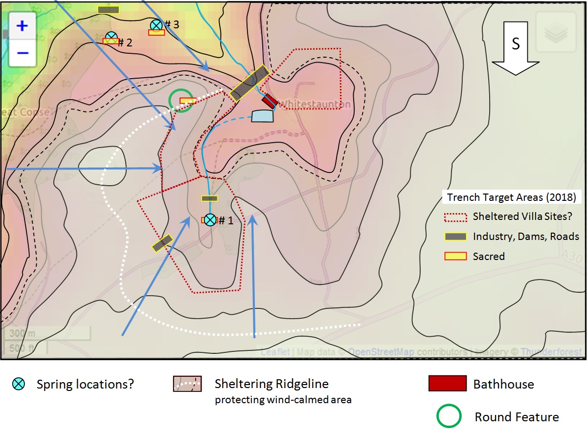
Trench Target Speculations
- Sheltered Areas: Broad areas of ground
- Sacred & Industrial Sites: of particular interest