
Also available: sketch with hypothesized ‘Sequence of Events’ sketch series with a ‘Mitigation Design’ concept sketch
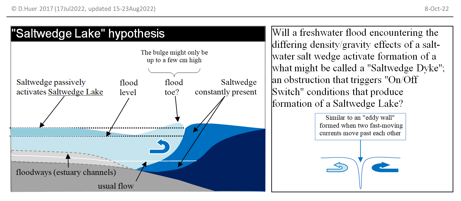
 Outside the remit of 2017 contract work for waterbucket.ca, I developed the hypothesis that the 2009 Lower Cowichan River flood became unusually worse because of the volume of flooding coupled with the architecture of the estuary.
The hypothesis is that the architecture (the natural and built topography and the ocean bottom of the exit to the sea) in certain conditions unusually leads to the creation of what I’ve termed “Saltwedge Lakes” and “Saltwedge Dykes” (the coined term “Saltwedge” referring to the hypothesized shape of formation of “salinity differentials”; which is the salinity differences of freshwater and saltwater meeting in a confined space).
Click for larger picture